ANZAC Bridge - Sydney
Walking and Cycling
Walking and Cycling on ANZAC Bridge
The northern side of the ANZAC bridge has a shared pedestrian walk way and cycle way. This way provides excellent views up the harbour from the old Glebe Island bridge to the Sydney Harbour bridge. The Australian digger statue, the New Zealand soldier statue and their commemorative plaques can be viewed close up.

Along the walkway from the rest station
at the top of the ramp on a Sunday morning (2020)

The walk way links the suburbs of Pyrmont on the Sydney city side to Lilyfield to the west.
You can start from the Pyrmont side at the spiral ramp near the corner of Quarry Master Drive and Saunders Street in Pyrmont.
Directions - Find your way to the ramp from the city by walking, cycling or public transport -
go to the bottom of this page.
The rest station at the top of the Ramp has a plaque called "A Little History" Details on the earlier bridges as well as construction time lines and statistics about the current bridge. Facts and Figures

The spiral ramp
from Quarry Master Drive Pyrmont
OpenStreetMap - Location of Ramp.

Take your camera - there are some great artistic shots to be had.


Approaching the middle of the bridge

Halfway across the bridge a plaque commemorates the joining of the two halves on the 24th July 1995.
A time capsule is embedded behind the plaque. But there are no clues as to what is in the capsule or when it is to be opened.

Looking over towards the Sydney harbour bridge you can see the old Glebe Island bridge It is permanently open although closed for sporting events such as the Sydney Marathon which now uses the old bridge instead of ANZAC Bridge. (2009)
It is now difficult to take pictures like this owing to the small mesh size of the new safety fence. Perhaps some well placed camera "peep holes" should be provided.

The Australian Digger

Looking across the roadway to
the New Zealand soldier.
The western side of the main deck is home to the two commemorative soldier statues. On the northern, walkway, side is the Australian Digger with the New Zealand soldier across the road.
A walk way next to the Australian Digger takes you around under the bridge to the New Zealand Soldier.
The structure on the underside of the bridge is well worth a look.

From the Australian Digger statue you can either return across the bridge or continue until you reach the Rozelle Parklands turnoff.
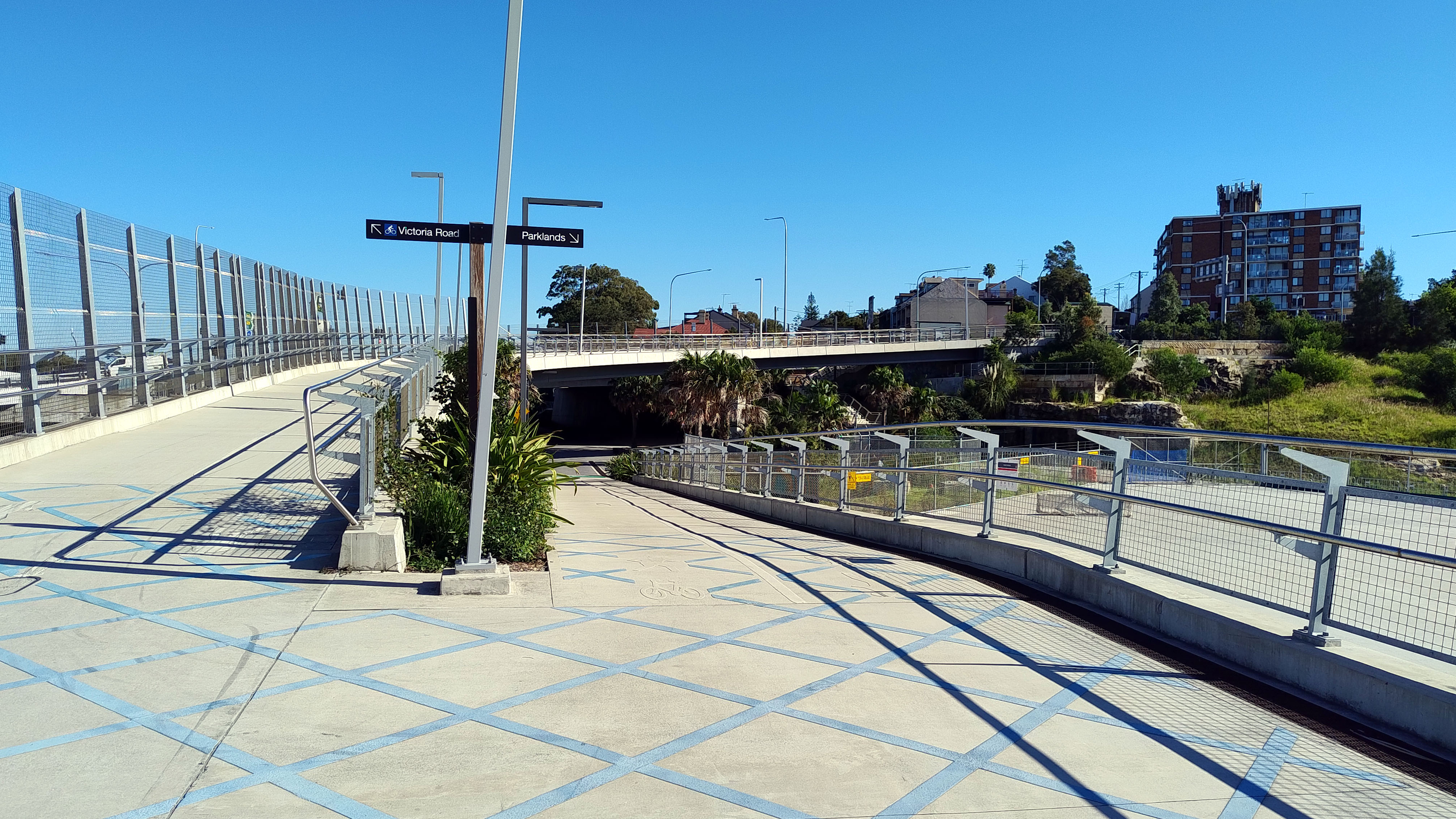
To your left the path leads to Victoria Road and a bus stop that will take you back to the City or to the right heads you under Victoria Road to the Parklands.
Rozelle Parklands sits above the tunnels of the Rozelle interchange on the site of the former rail yards. It has extensive playing fields, wetlands and picnic/BBQ facilities. Wikipedia - Rozelle Interchange and Parklands
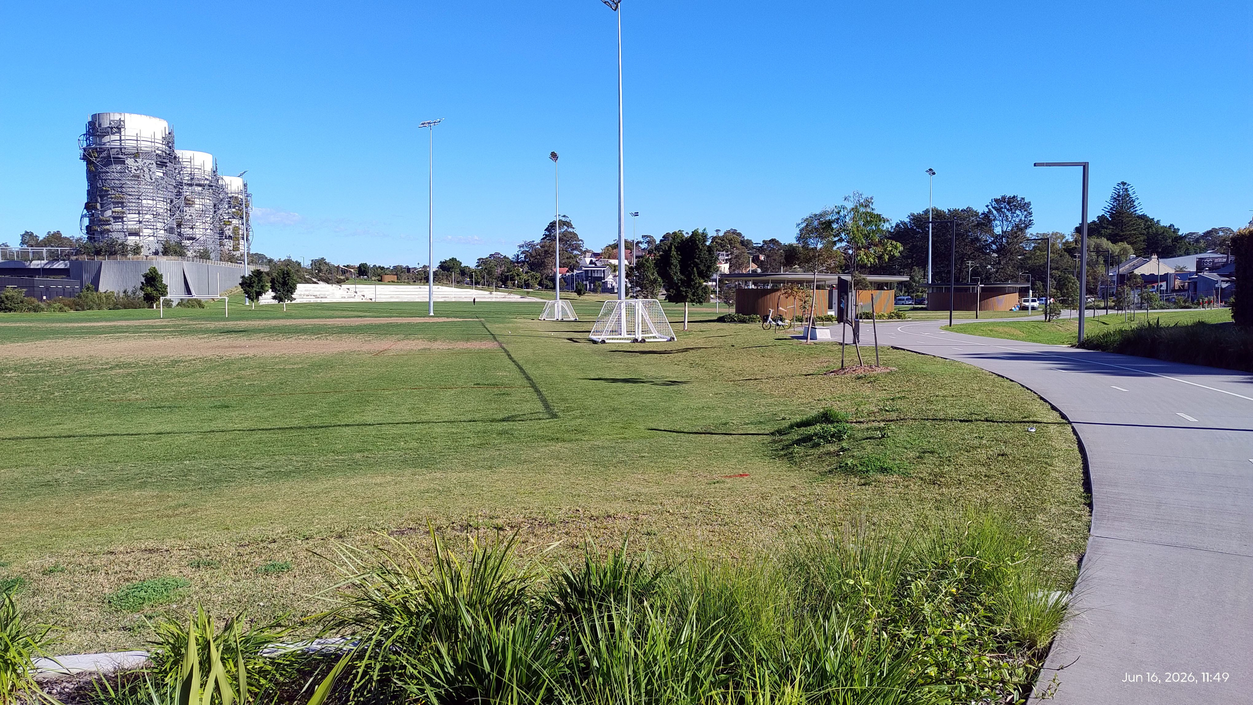
Part of the playing fields
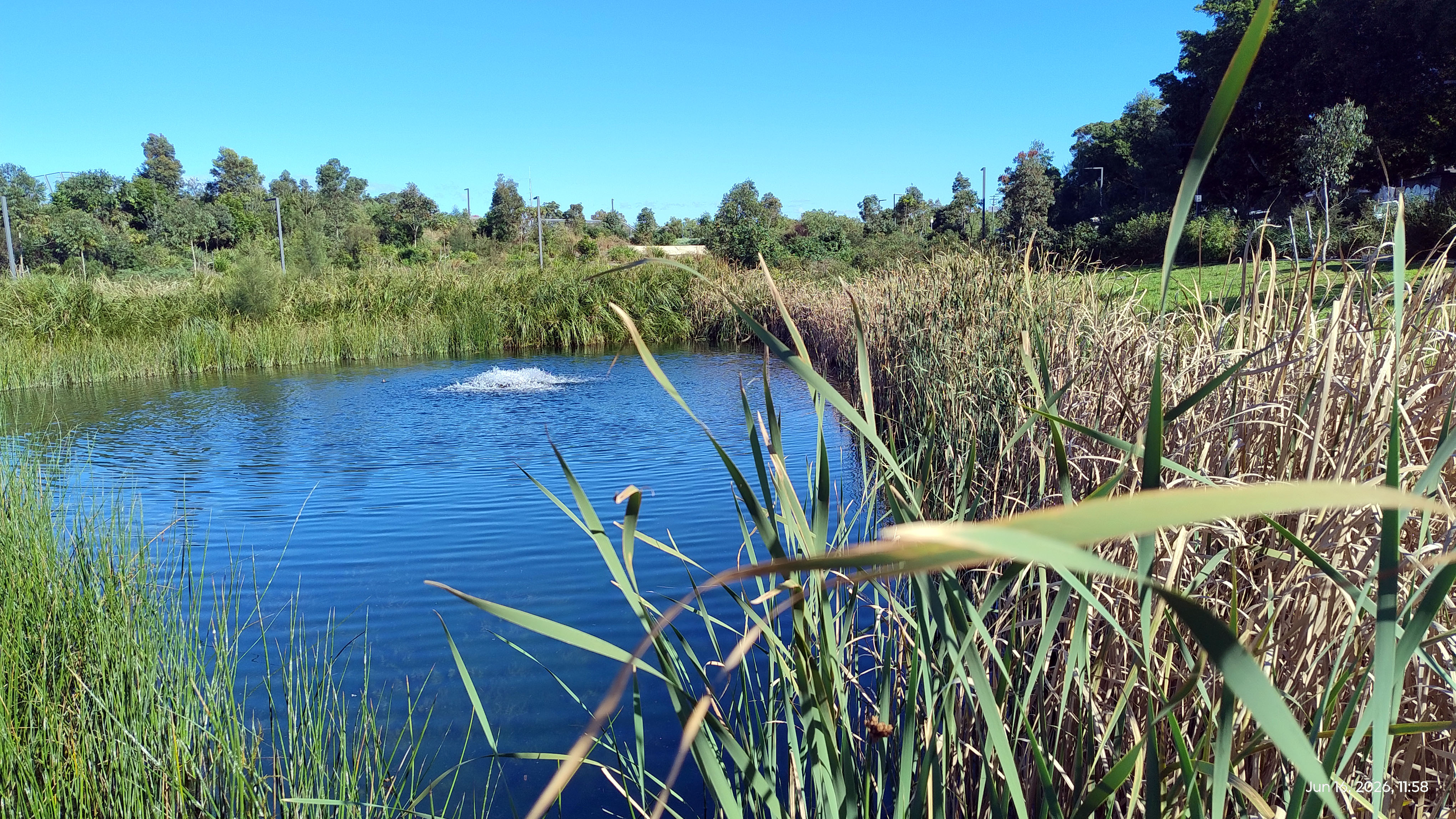
Wetlands.
From within the parklands the shared pathway takes you over the Western Distributor near the tunnel stacks to the Rozelle Bay light rail stop. The light rail will take you back to the city at Central Station.
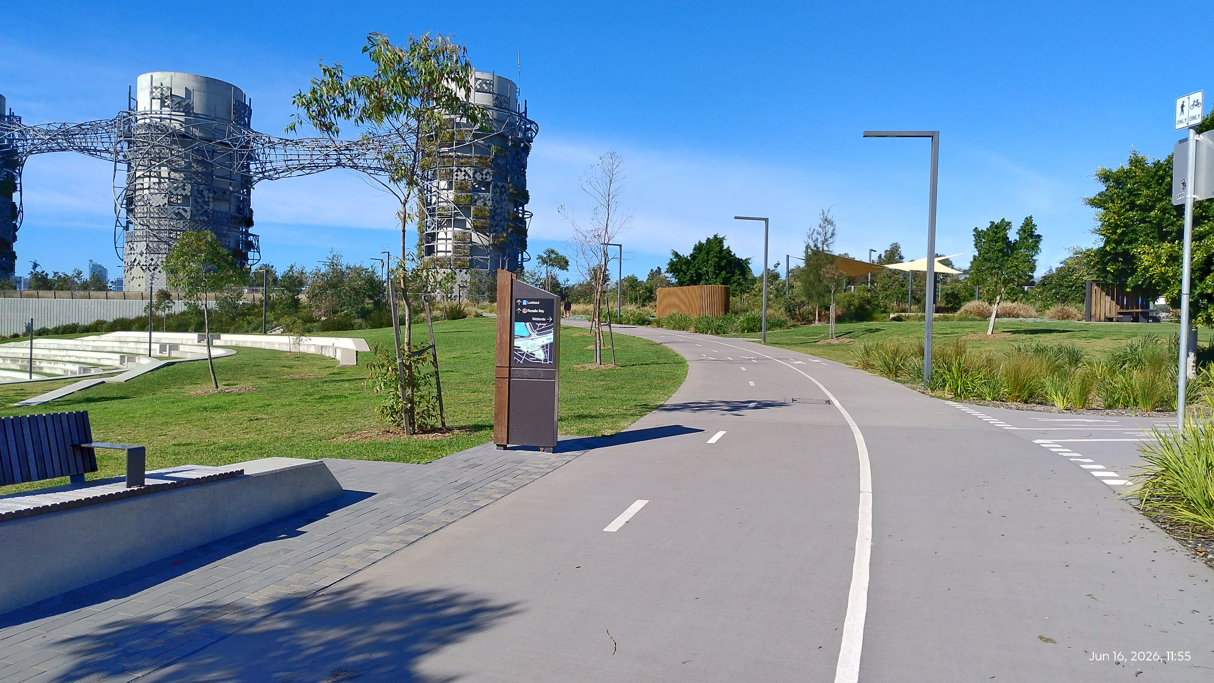
To the light rail with wetlands or play grounds to the right
Follow the cycle and walking path - blue dashes on OpenStreetMap. Drag the map to follow the path.
The WestConnex Development - Archive
The WestConnex Development at Rozelle and on the approaches to ANZAC Bridge resulted in major disruption to walking and cycling on the western approaches. It required the removal of two walkway/cycleway bridges - the Beatrice Bush Bridge and the bridge over Victoria Rd near Lilyfield Rd.
The shared walkway/cycleway path to the ANZAC bridge from Victoria Rd and the Cauarina trees lining it was also removed in early 2020.

The walkway/cycleway path to the ANZAC bridge from Victoria Rd - removed 2020

The Beatrice Bush Bridge - removed 2020

Beatrice Bush sold newspapers seven days a week, whatever the weather, at the intersection of Victoria Road and The Crescent White Bay for more than 25 years.
Selling from the traffic island, her customers were the drivers coming off ANZAC Bridge (or before that the old Glebe Island Bridge) waiting at the lights at the Victoria Road intersection.
It is fitting that the walk way over Victoria Road adjacent to her traffic island was named in her honour (2005).
An image of Beatrice can be found at Getty Images.
How to find the Ramp to the ANZAC Bridge walkway - Pyrmont end.
|
Map |
OpenStreetMap Location of Ramp - Pyrmont end. |
|
Walking |
Have a look at the Google Maps Satellite view to find your way walking from Darling Harbour or Sydney city. |
|
Bus |
The 389 bus travels from North Bondi to Star City/Maritime Museum via Park St in the city. Get off at the Miller St intersection of Harris St. Check Sydney Buses Timetables. Enter 389 in the Route number box. |
|
Light Rail |
Light Rail The Metro Light Rail has a station nearby at the Bank Street. Catch the light rail from Central Station, Paddys Markets or Darling Harbour (Convention station). Have a look at their Network Map for details. |